Spectral angle mapper
The Spectral angle mapper can be used to find other areas of an image that match a given spectrum. The spectrum can be drawn from either spectra previously added to the project, or a spectrum can be computed on the fly using a vector layer. The algorithm measures spectral similarity by calculating the angle between the input raster dataset and the targets, also known as cosine similiarity.
Note
For spectral input layers, using a vector layer as input is equivalent to computing a spectrum from the vector and using that spectrum as the target.
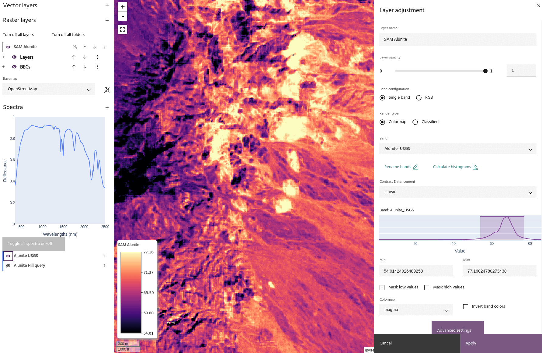
The above image shows two SAM results on the Fused Bare Earth Composite in the Cuprite region of Nevada, with a goal of mapping Alunite. One result comes from an Alunite spectrum from the USGS library, and the other comes from a spectral query on a known Alunite area. Notice how the scores from the library spectrum are lower than those coming from the data directly, but both results show the same trend.
Note
Spectra will be automatically resampled to the data wavelengths if necessary.
Usage
The spectral angle mapper dialog allows you to choose the
raster layer and bands
to use as input data, and vector and
spectra to use as targets. Choose a name
for the output layer and select Run SAM to create the output in the
raster list. The output layer will have one band per chosen target.
Note
Non-spectral input data will only allow vector targets.