Add vector layers to a Marigold project
Marigold supports several methods for adding vector layers to your project.
Draw a vector layer
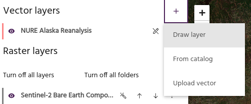
Select Draw layer to create a vector layer by manually drawing one on the map.
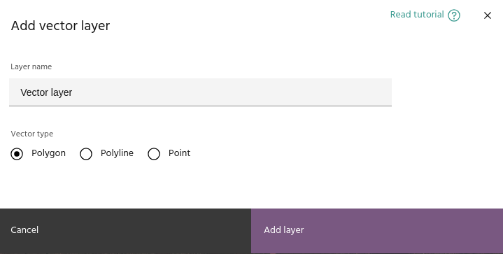
The dialog allows you to type a name for the vector and select the geometry
type. Available options are Polygon, Polyline, and Points. After clicking
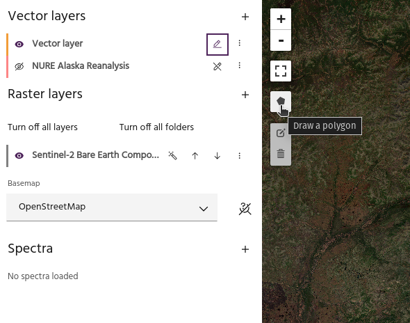
the Add layer button, the new vector will appear in the layer list. Click the
draw icon to toggle drawing, then click the new icon
on the map to begin the drawing session.
Tip
The icon on the map will indicate whether the drawn layer will be a polygon, point, or polyline.
Click on the map to draw the desired vector object.
- For polygons, finalize the polygon by clicking the first point to close the polygon.
- For polylines, finalize by clicking the last point.
- For points, each individual point will be drawn separately.
Add a vector layer from the Catalog
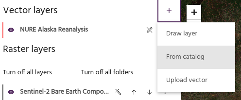
Similar to raster layers, objects stored in the Vector service with the appropriate tags are available to load into Marigold. Contact support for assistance with correctly loading data.
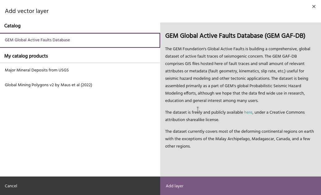
Click on a layer to see any available details, then click Add layer to add the
layer to the map.
Tip
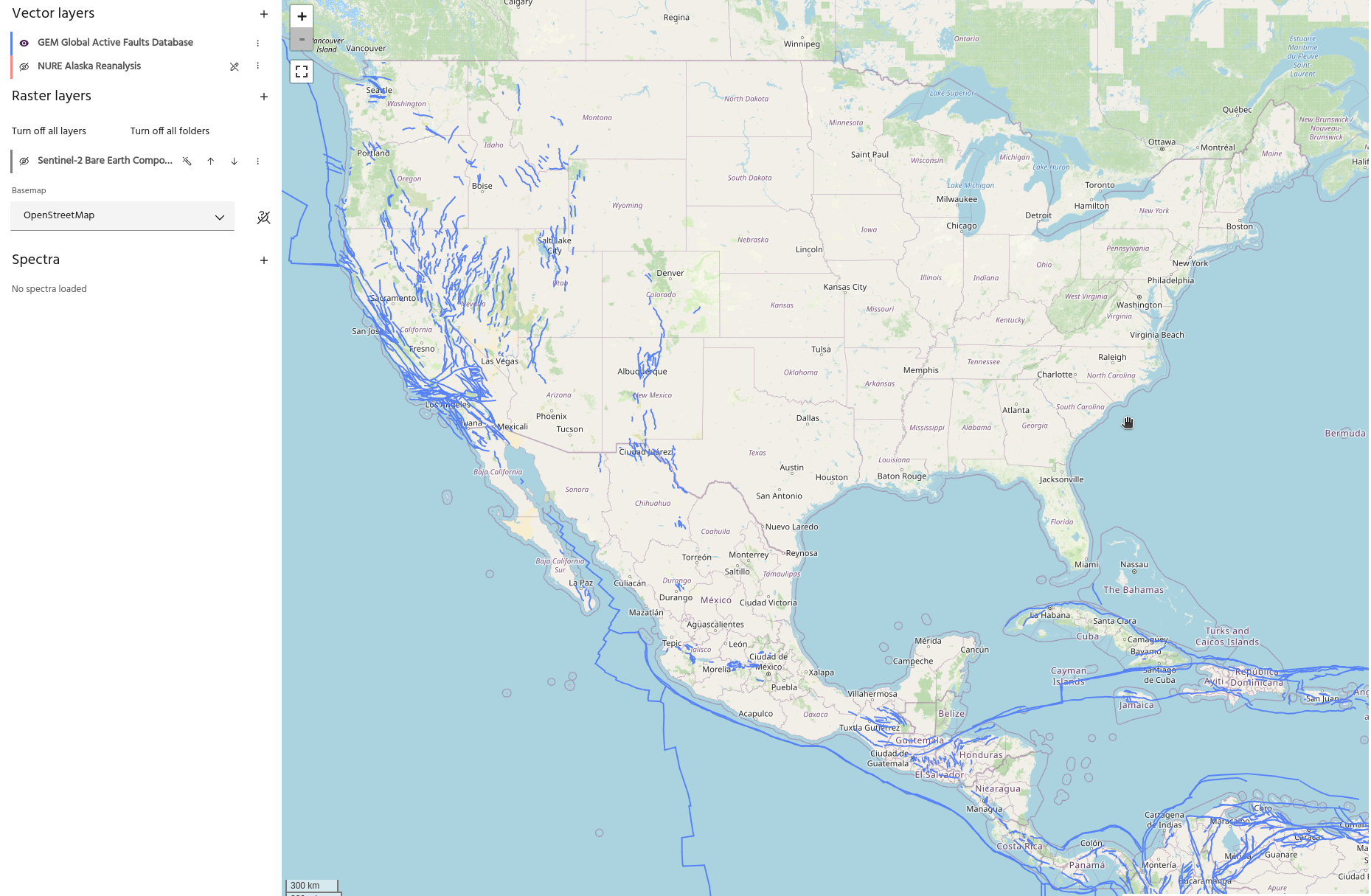
Large vector files, such as the global fault database shown above, will be significantly more responsive when loaded from Catalog than when loaded from local files (geojsons, shapefiles, etc).
Warning
Development for vector layers from Catalog is ongoing, and not all features are supported yet.
Upload a vector layer
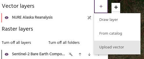
Select the Upload vector option to load a vector layer from your local
computer. Valid formats for loading vectors include:
- GeoJSONs
- Shapefiles (as
.ziparchives) - GeoPackage (
.gpkg) - CSVs
- Parquet
- AutoCAD DXF
- KML/KMZ
Warning
Vector files have a large amount of variability from one software package to the next. Marigold attempts to load vectors using the GeoPandas package, which is successful for most vector files from common sources (QGIS, Arc, etc). For help loading non-standard vector layers, contact support.