Batch mask
Generally during a remote sensing workflow, several masks will need to be applied to a data layer before analysis can begin. Vegetation and water will need to be masked for most areas in the world, and oftentimes individual AOIs (built up areas, restricted land, etc) will need to be removed as well. The batch mask tool allows a user to apply several masks to many layers at once, quickly preparing layers for further analysis.
Usage
Once all your masks are built and properly assigned as masks, the batch mask tool will show lists of:
- Mask rasters
- Vectors
- Non-mask rasters
Any number of masks (both vector and raster) can be selected and applied to any number of rasters.
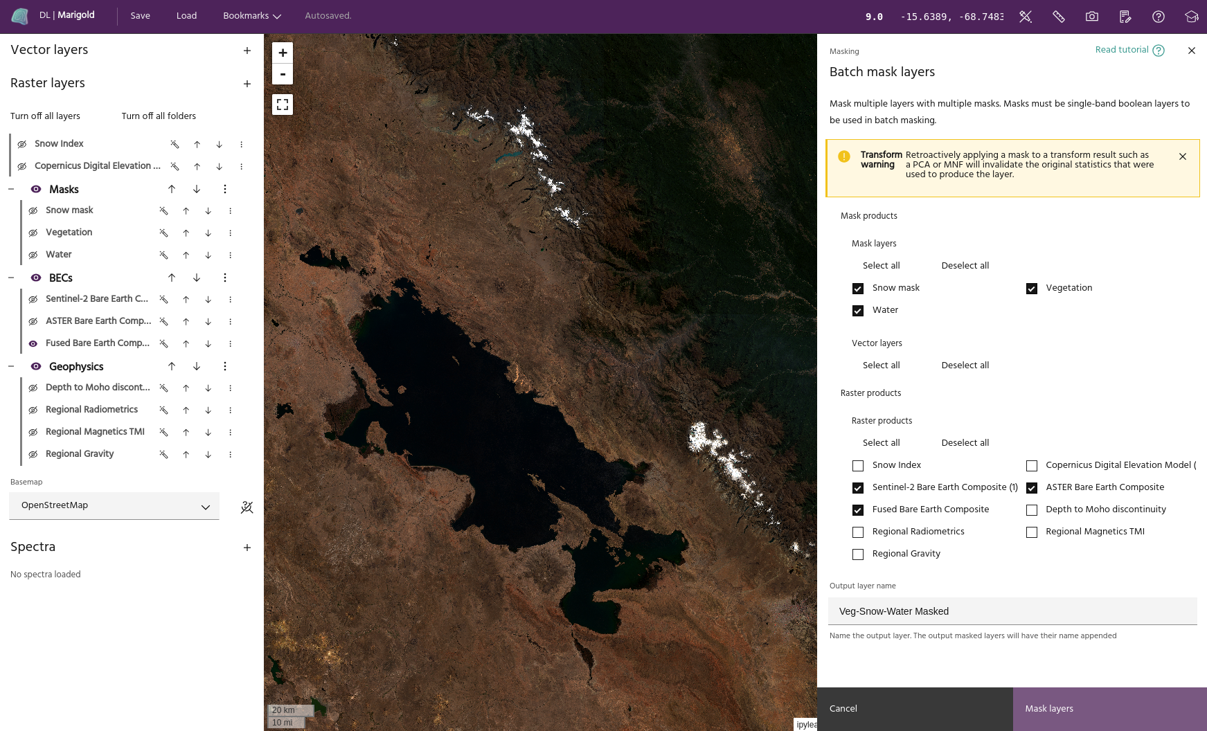
In the above example, we are applying the vegetation and
water output from those tools, as well as a snow mask built
using the raster calculator. We will apply all masks to
the three Bare Earth Composite products we have loaded. Click Mask layers to
apply the masks.
Tip
The output name will be appended to the input layer's name for the final masked
products. In the above example, masking the Fused Bare Earth Composite layer
will generate a layer named Fused Bare Earth Composite_Veg-Snow-Water Masked.