The Iris header bar
The header bar in Iris contains several tools for adding baselayers, manipulating the map, and links to further information on Iris itself.

Bookmarks
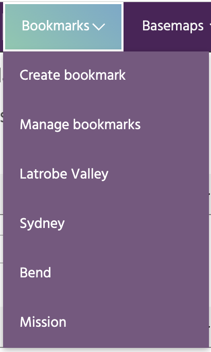
Bookmarks are a convenient way to store locations that you will return to often.
Each bookmark is defined by a latitude/longitude location and a zoom level.
Clicking on a bookmark will move the map to the defined center and zoom. Click
Create a bookmark to add the current map location as a bookmark, or click
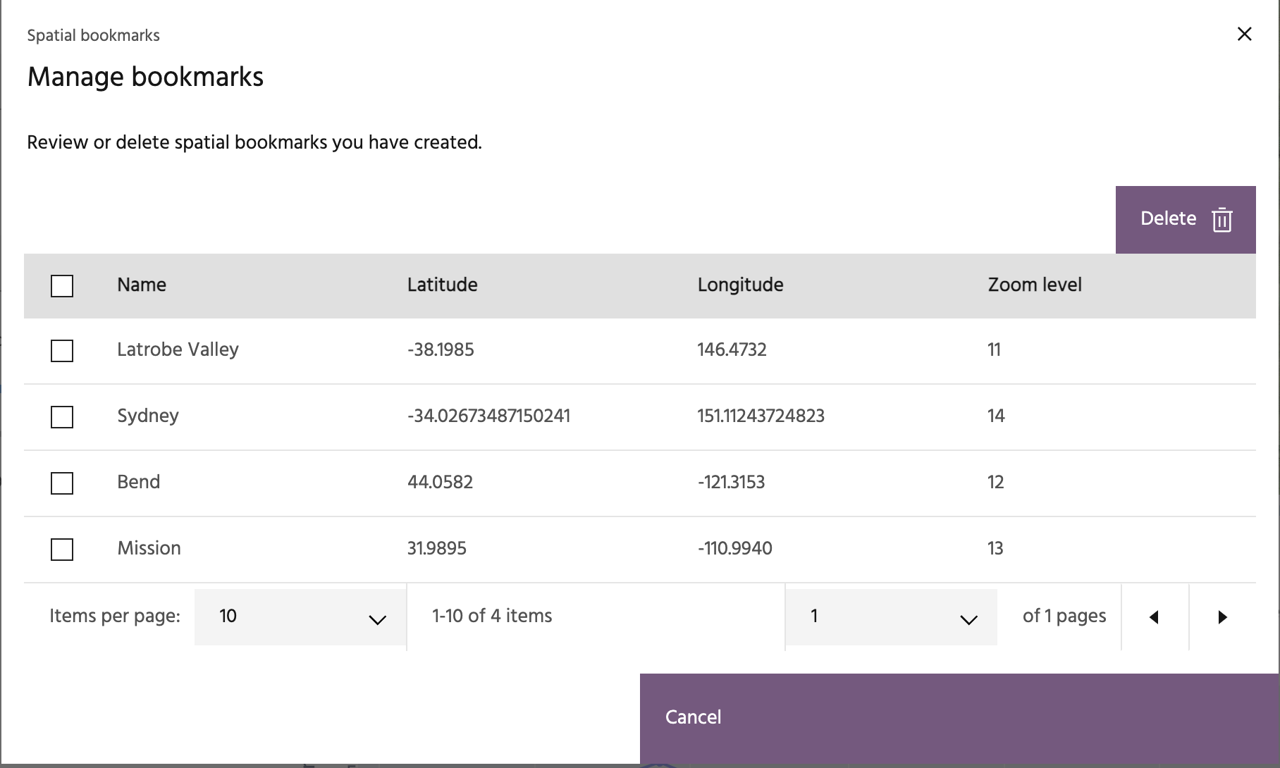
Manage bookmarks to review and manage your current bookmarks.
Basemaps
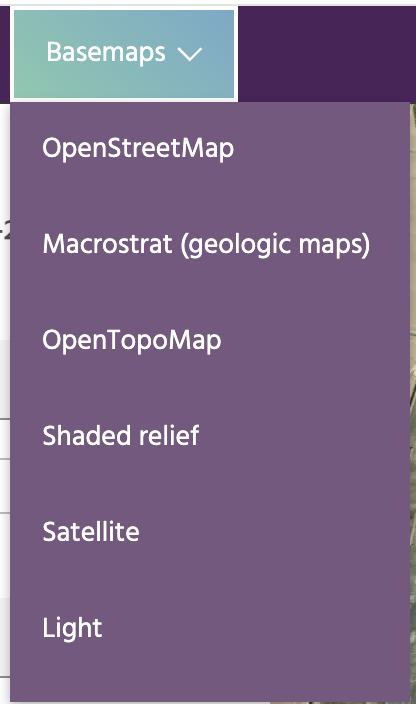
Basemaps provide different images underlying the deformation points to help interpret what you're seeing on the map. These include free optical imagery, shaded relief, OpenStreetMap, and more.
Zoom and center

Controls the center latitude/longitude value and zoom level of the map.
Pixel inspector

The pixel inspector will extract the pixel values for currently visualized layers that are from Optical Imagery and Derived Layers. Click the icon to start an inspector session, and click on the map to extract a point. Clicking the map in another location will move the inspection point and recompute the values shown in the box.
Changelog

Click this icon to bring up the release notes for the most recent Iris version.
Help

The help icon links to this documentation.