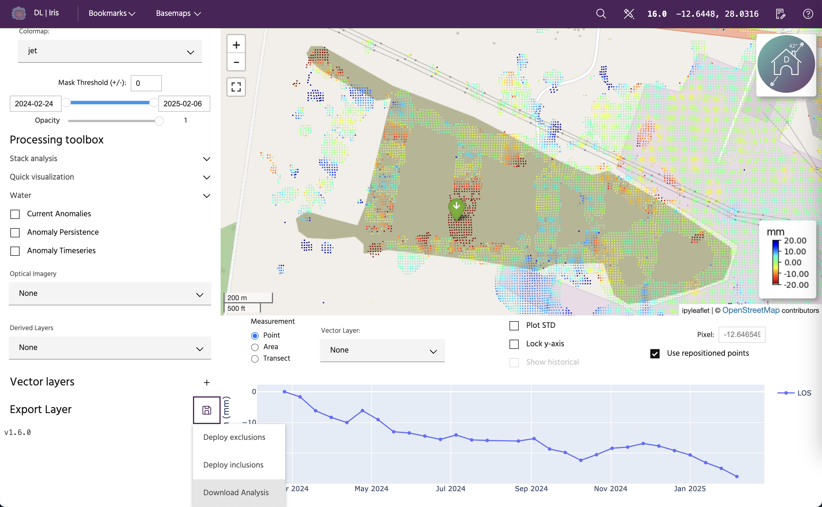
Export data
Data available in iris can be downloaded for use in other software. To download data, scroll to the bottom of the left panel and click the save icon next to the Export Layer label.
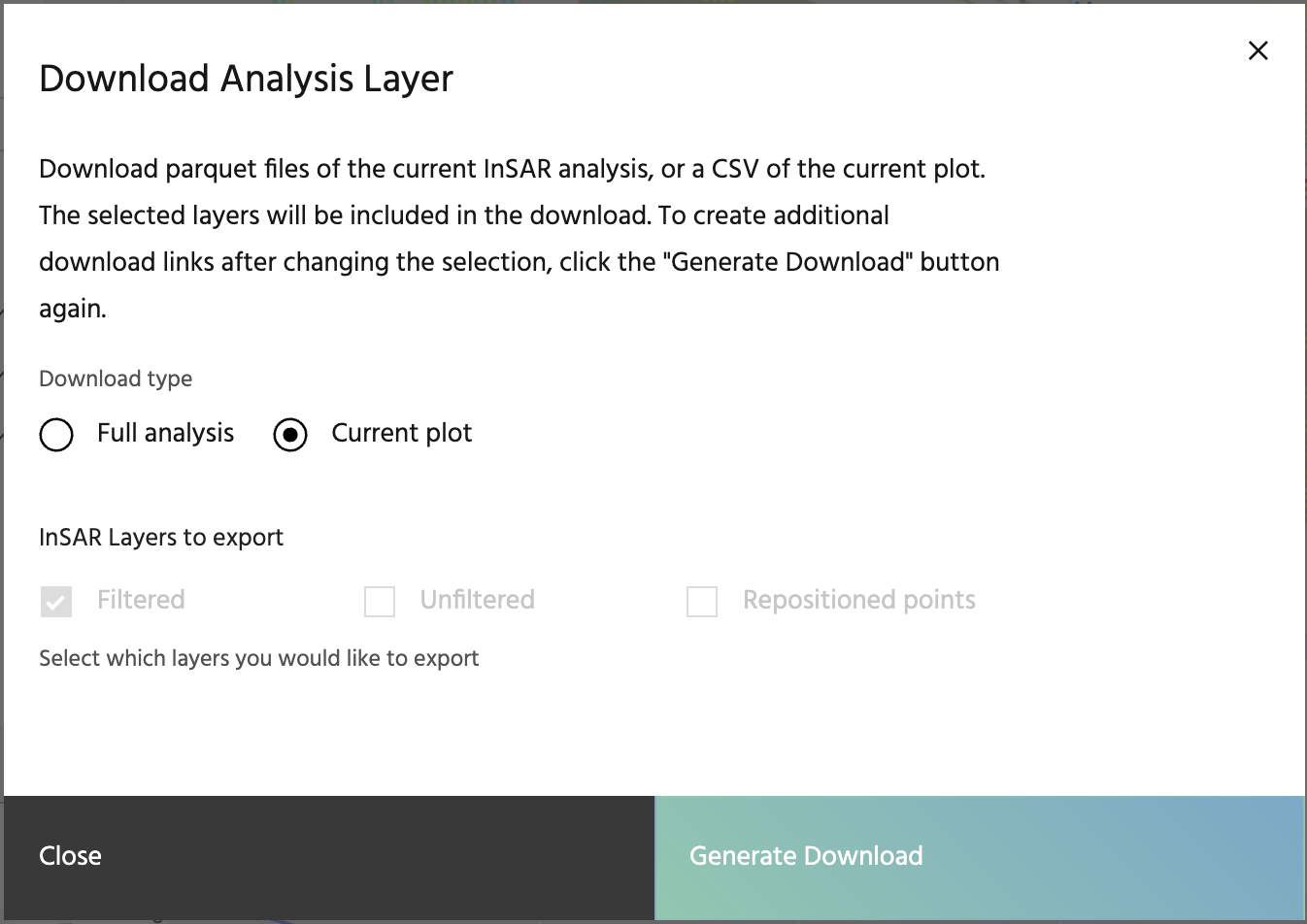
Download .parquet file
To download the entire analysis as a parquet file, first select the layers you would like (Filtered, Unfiltered, and/or Repositioned points), then click on the Generate Download button. This will create a link that you can click on to start your download. MGRS, EASTING, NORTHING, VEL, ACC, STDDEV, ALERT, COHERENCE, LAT, LON, and geometry will be downloaded as well as the layers you have selected, when available.
Tip
If you'd like to download a different set of data, click the Generate Download button a second time to recreate the download link.
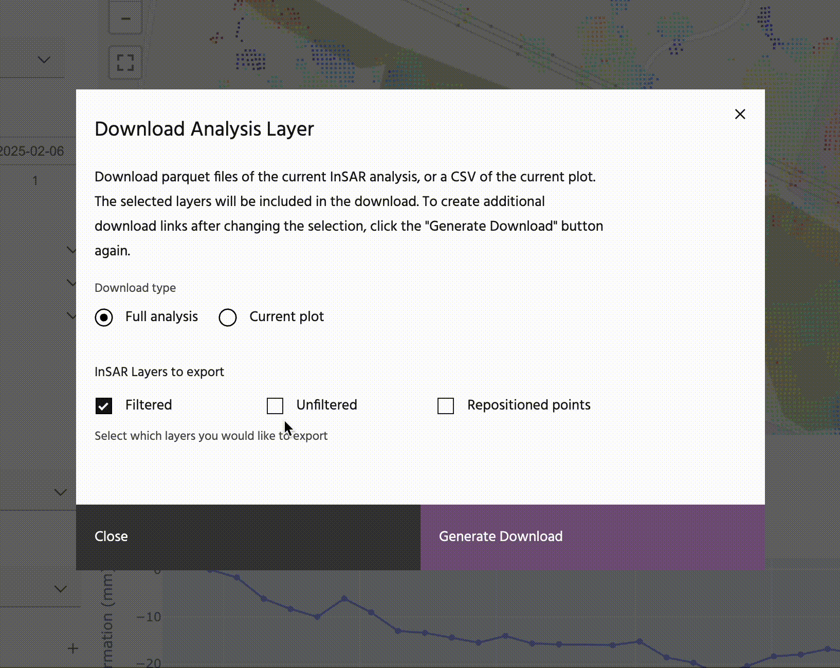
Download current plot
To download the current data shown on the plot, toggle the button to the Current plot option. Selecting Generate Download will automatically download a .csv file containing whatever data is currently on the plot. If point data is selected, the latitude and longitude will be included in the file name. If a transect or area is selected, the name of the polyline/polygon will be included in the file name. All data shown on the map, including deformation, historical data, standard deviation, etc. will be included in the output, with the exception of velocity and acceleration. In the case of point and area plots, dates will be included for each point. In the case of transect data, the latitude and longitude of each point will be included.